![]() The computer-assisted
survey and mapping of the standing architecture at the site, which was
initiated in 2002, is a crucial stage in the progress of our research.
The monumental sector alone covers some 150 hectares. Until now the only
map of the site has been the one made by Max Uhle in the XIXth century
(Uhle 1903). Although the work is of high quality, it is not suitable for
present-day research since its scale is too small (1/2000) and the structures
are not shown in sufficient detail. The limits of each structure are poorly
defined on his map and the nomenclature needs to be refined. Our goal is
to achieve an up-to-date map of the site via computer-aided technology
in order to facilitate the archaeological and architectural analysis of
the area through GIS and 3-D reconstructions. Considering the total size
of the site of Pachacamac (600 hectares, one quarter of which comprises
the monumental sector), it is obvious that several field seasons, from
2002 to 2007, will be required to achieve our objective of a complete map
of the site.
The computer-assisted
survey and mapping of the standing architecture at the site, which was
initiated in 2002, is a crucial stage in the progress of our research.
The monumental sector alone covers some 150 hectares. Until now the only
map of the site has been the one made by Max Uhle in the XIXth century
(Uhle 1903). Although the work is of high quality, it is not suitable for
present-day research since its scale is too small (1/2000) and the structures
are not shown in sufficient detail. The limits of each structure are poorly
defined on his map and the nomenclature needs to be refined. Our goal is
to achieve an up-to-date map of the site via computer-aided technology
in order to facilitate the archaeological and architectural analysis of
the area through GIS and 3-D reconstructions. Considering the total size
of the site of Pachacamac (600 hectares, one quarter of which comprises
the monumental sector), it is obvious that several field seasons, from
2002 to 2007, will be required to achieve our objective of a complete map
of the site.
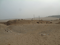
 Excavation and clearing work in progress at Pyramid n°8 (2004) |
 Survey and mapping with a Laser Total Station (2002) |
Topography, Mapping, and Computer-Assisted Draughtmanship
![]() Architectural studies are assuming a more important role in research
into pre-Hispanic monumental sites. Such studies now encompass not only
the style of the building and its construction phases, but also fresh
approaches to built spaces, e.g. the application of models from landscape
studies, the consideration of architecture as an instrument for social
control, and thermodynamism, all of which require an enormous quantity
of numerical data and computers to process it. One of the advantages
of computerization is the fact that it allows multiple applications and
other complementary uses of the same database. As regards pyramids with
ramps, we propose creating 3D virtual models of the structures, a procedure
we have initiated in mapping pyramid 3.
Architectural studies are assuming a more important role in research
into pre-Hispanic monumental sites. Such studies now encompass not only
the style of the building and its construction phases, but also fresh
approaches to built spaces, e.g. the application of models from landscape
studies, the consideration of architecture as an instrument for social
control, and thermodynamism, all of which require an enormous quantity
of numerical data and computers to process it. One of the advantages
of computerization is the fact that it allows multiple applications and
other complementary uses of the same database. As regards pyramids with
ramps, we propose creating 3D virtual models of the structures, a procedure
we have initiated in mapping pyramid 3.
This procedure is designed, firstly, to show in visual terms the results of the excavations and the hypotheses that stem from them, i.e. stratigraphic correlations between different areas of one building, some of which can cover several hectares ; the succession of architectural phases, which can overlap one another ; the reconstruction of the internal circulation system at the different stages of occupation ; the modelling of the building methods ; and the representation of the possible original state of a building with its roof, paintings, and decorative features.
Secondly, the results will serve as archives showing the state of the building before any conservation or restoration was attempted.
Thirdly, 3D animation will result in a « virtual visit » of the site, accesible from a website, shown in the Site Museum as a complement to the normal site tour of Pachacamac. It can be made available on CD-Rom with related research data for the scholarly community, students, etc. As the investigations advance, plans and interpretations can be improved and modified, as necessary, in order to reflect and to test different hypotheses.
With regard to the computerized survey and mapping of the whole site, advantages and applications are obvious : easy availability of maps at any scale, detailed plans, a comparative database for the various structures, ability to visualize the site growth over time, etc.
It can be seen that survey and mapping of this important site are essential not only for the Ychsma project, but also for the whole scientific community. The work will provide enough data for our own purposes and serve as a reference point for identifying and evaluating the various components of the site.
We are very grateful to the Belgian Embassy in Lima
for its logistic support
![]()